As much as 4.5 inches of rain are expected Sunday night into Monday morning, as a powerful storm rolls into North Jersey just in time for the Monday commute.
Forecasters expect no snow to speak of, said Bryan Ramsey, a meteorologist for the National Weather Service office in Upton, New York.
But the rain is enough of a threat, given the heavy precipitation −4 inches in some parts of New Jersey − that came with last week’s major storm on Dec. 10.
“We did see a good amount of rainfall with the last system,” Ramsey said on Sunday. “The soil is already wet. The rivers have extra water in them. When we see more rainfall, we could see flooding with this system.”
The wet weather is the result of a storm driving gale-force winds, heavy rains and flooding that roared toward a long stretch of the East Coast on Sunday, creating conditions for a possible “bomb cyclone” poised to wreak havoc ahead of the holiday season.
Flood watch, wind advisories for northeastern NJ
A flood watch is in effect for the entire state of New Jersey through Monday afternoon. In North Jersey, it will expire 5 p.m. Monday.
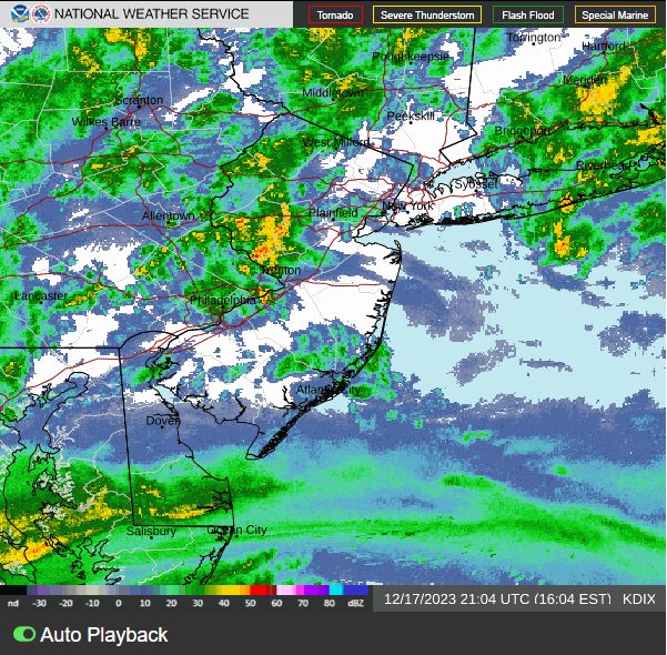
A 3 p.m. update by the Weather Service predicted rainfall totals of 2 to 4 inches with locally higher amounts, possibly as much as 5 to 6 inches. Tonight and tomorrow morning will see the worst of it, Ramsey said. The rain is expected to taper off tomorrow evening.
A wind advisory was also in effect for northeastern New Jersey, with gusts from the southeast possibly reaching 35 to 45 mph.. “Tree limbs could be blown down and a few power outages may result,” the agency said.
It also declared a coastal flood warning in eastern Bergen, Essex, Union and Hudson counties from 10 a.m. to 4 p.m. Monday, with 1 to 2 feet of inundation above ground level being possible at high tide. “It could affect parking lots, coastal lawns, home businesses near the waterfront,” Ramsey said.
Lower temps, possibly flurries, on Monday night
Because the powerful low-pressure system originated in the Gulf of Mexico, it brings warmer air with it, with temperatures expected in the mid- to upper-50s Monday.
When the system leaves, temperatures are expected to drop sharply: down to mid to upper 40s Monday evening, with the wind coming from the west, and then low to mid 30s at night. That’s the point, if any, when there might be a possibility of snow flurries. “It could get cold enough to see some light snow, but not much accumulation,” Ramsey said.
Flooding remains the central threat. Commuters, Ramsey said, should to stay tuned to their local radio stations and weather apps. Don’t drive through flooded roads and pay attention to barriers. Remember: what looks like a puddle could be a disaster waiting to happen, he cautioned.
“Does 6 inches of water, a foot of water, seem like a lot to you?” Ramsey said. “Well 6 inches of water, for most passenger vehicles, can cause you to lose control and stall your vehicle. And a foot or water will float most cars.”
A winter hurricane developing
Along the Eastern Seaboard, more than 32 million Americans were under a wind advisory, the National Weather Service said. AccuWeather meteorologist Bernie Rayno said winds will reach from 40 and 70 mph along the coast, with gusts of up to 85 mph possible. Gusts of 74 mph or greater are considered hurricane-force winds − a bomb cyclone is essentially a winter hurricane.
“There is the likelihood of damage along the mid-Atlantic and New England coasts from this storm as it intensifies rapidly,” Rayno said. “A zone of strong winds (will push) water from the Atlantic toward the shoreline, while at the same time, heavy rain pours down.”
A stretch from North Carolina to Maine will see up to 4 inches of rain, and some highly localized areas could see up to 10 inches, AccuWeather said. Roads could become awash in water, snarling traffic Sunday night and for Monday’s morning rush hour.
The storm was rolling up from Florida and Georgia, and 35,000 homes and businesses in those states were without power early Sunday.
This article includes reporting from USA Today.
This article originally appeared on NorthJersey.com: New Jersey is on flood watch as powerful storm moves up East Coast

Amanda Smith is a dedicated U.S. correspondent with a passion for uncovering the stories that shape the nation. With a background in political science, she provides in-depth analysis and insightful commentary on domestic affairs, ensuring readers are well-informed about the latest developments across the United States.