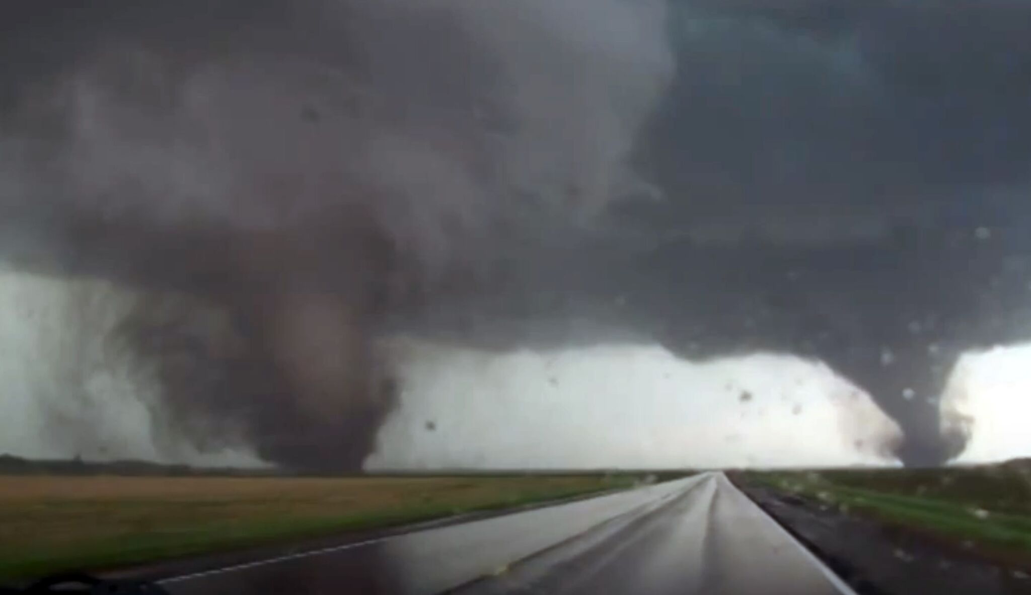
This frame grab taken from video provided by StormChasingVideo.com shows two tornados approaching Pilger, Nebraska, on Monday June 16, 2014.
StormChasingVideo.com/APA Tornado Watch was issued for Madison County, Illinois, until midnight tonight by the National Weather Service. The initial tornado watch was issued at 4:50 p.m. CT on Monday, April 1.
The tornado watch updated at 10:30 p.m. cautions of tornadoes possible, 2-inch-sized hail likely, and wind gusts up to 75 mph likely.
Article continues below this ad
The Illinois counties that received the extended tornado watch until 3 a.m. on Tuesday are Madison County, Bond County, Clinton County, Fayette County, Jersey County, Macoupin County, Marion County, Monroe County, Montgomery County, Randolph County, St. Clair County, and Washington County.
In the tornado watch at 4:50 p.m. on Monday, the National Weather Service cautioned of a danger of tornadoes; scattered hail up to tennis-ball size likely; and scattered wind gusts up to 70 mph likely.
The initial tornado watch that ended at midnight was for Bond County, Calhoun County, Christian County, Clark County, Clay County, Clinton County, Coles County, Crawford County, Cumberland County, Douglas County, Edgar County, Effingham County, Fayette County, Greene County, Jasper County, Jersey County, Lawrence County, Macon County, Macoupin County, Madison County, Marion County, Monroe County, Montgomery County, Morgan County, Moultrie County, Pike County, Richland County, Sangamon County, Scott County, Shelby County, St. Clair County, and Washington County.
Article continues below this ad
Severe thunderstorm warning for Madison County
The severe thunderstorm warning statement said, “A severe thunderstorm was located over Hartford, moving east at 35 mph. Hazard ping-pong ball-size hail and 60 mph wind gusts. Source, radar indicated.”
The severe thunderstorm warning stated the impact is to “people and animals outdoors will be injured. Expect hail damage to roofs, siding, windows, and vehicles. Expect wind damage to roofs, siding, and trees.”
Article continues below this ad
Locations impacted by the severe thunderstorm warning include Granite City, Edwardsville, Glen Carbon, Wood River, Highland, Bethalto, Pontoon Beach, Madison, East Alton, South Roxana, Roxana, Hartford, Worden, Marine, Livingston, Alhambra, Rosewood Heights, Carpenter, Hamel, and Grantfork. This includes Interstate 55 in Illinois between exits 23 and 33.
The tornado watch and severe thunderstorm warning came after a hazardous weather outlook from the National Weather Service was issued at 2:51 p.m. CT on Monday.
What is a tornado watch?
Article continues below this ad
In a tornado watch, the National Weather Service advises to “review and discuss your emergency plans and check supplies and your safe room. Be ready to act quickly if a warning is issued or you suspect a tornado is approaching.”
What is a tornado warning?
A tornado warning means to take action, according to the National Weather Service.
Article continues below this ad
If a tornado warning is issued, the National Weather Service says that means “a tornado has been sighted or indicated by weather radar. There is imminent danger to life and property. Move to an interior room on the lowest floor of a sturdy building. Avoid windows. If in a mobile home, a vehicle, or outdoors, move to the closest substantial shelter and protect yourself from flying debris.”

Sarah Wilson is your guide to the latest trends, viral sensations, and internet phenomena. With a finger on the pulse of digital culture, she explores what’s trending across social media and pop culture, keeping readers in the know about the latest online sensations.