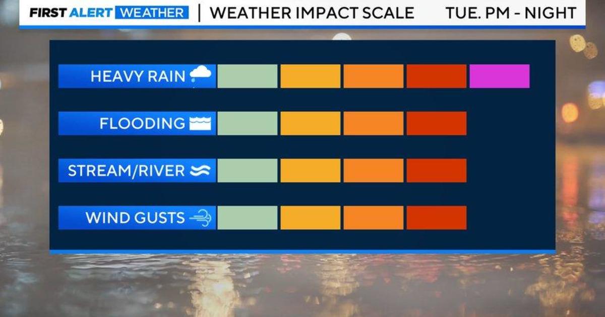
BALTIMORE — Tuesday’s storm is now in the process of exiting the area. Tonight, a cold front will move through the region, bringing showers and light rain into Wednesday morning.
In far western Maryland, expect snow showers to increase Wednesday morning and last through the night. A *WINTER WEATHER ADVISORY* is in effect for western Maryland.
Besides that, most other locations will see drier conditions Wednesday due to westerly winds bringing drier air into the region. While winds will lessen late tonight, they are expected to pick up again on Wednesday.
The strongest winds are likely in the higher elevations of western Maryland. It will be breezy areawide with gusts over 30 mph into the afternoon.
From Wednesday afternoon through Thursday, high pressure will build to our area. Thursday looks like a fantastic day with highs in the 50s with sunshine.
Looking ahead to Friday a significant storm system will move into the mid-section of the country. Rain is expected to start in our area Friday afternoon.
The heaviest rain is likely Friday evening into the overnight hours as well as gusty winds. This storm is not expected to be as impactful to the area as the previous one, with less rainfall and winds not quite as strong, but will still cause disruptions if you have plans Friday night into Saturday morning.
Behind the storm system, colder air will filter in with highs in the 40s Sunday and 30s to start next week. There will be a chance for snow showers Monday into Tuesday but it does not look like a significant storm at this point. We’ll keep you posted.

Amanda Smith is a dedicated U.S. correspondent with a passion for uncovering the stories that shape the nation. With a background in political science, she provides in-depth analysis and insightful commentary on domestic affairs, ensuring readers are well-informed about the latest developments across the United States.