Sign up for CNN’s Wonder Theory science newsletter. Explore the universe with news on fascinating discoveries, scientific advancements and more.
Egypt’s Great Pyramid and other ancient monuments at Giza exist on an isolated strip of land at the edge of the Sahara Desert.
The inhospitable location has long puzzled archaeologists, some of whom had found evidence that the Nile River once flowed near these pyramids in some capacity, facilitating the landmarks’ construction starting 4,700 years ago.
Using satellite imaging and analysis of cores of sediment, a new study published Thursday in the journal Communications Earth & Environment has mapped a 64-kilometer (40-mile) long, dried-up, branch of the Nile, long buried beneath farmland and desert.
“Even though many efforts to reconstruct the early Nile waterways have been conducted, they have largely been confined to soil sample collections from small sites, which has led to the mapping of only fragmented sections of the ancient Nile channel systems,” said lead study author Eman Ghoneim, a professor and director of the Space and Drone Remote Sensing Lab at the University of North Carolina Wilmington’s department of Earth and ocean sciences.
“This is the first study to provide the first map of the long-lost ancient branch of the Nile River.”
Ghoneim and her colleagues refer to this extinct branch of the Nile river as Ahramat, which is Arabic for pyramids.
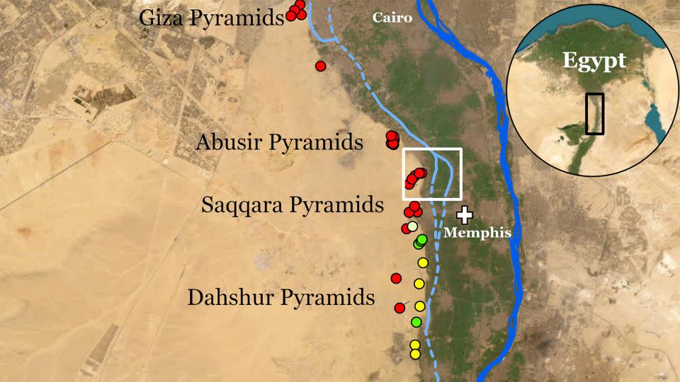
The ancient waterway would have been about 0.5 kilometers wide (about one-third of a mile) with a depth of at least 25 meters (82 feet) — similar to the contemporary Nile, Ghoneim said.
“The large size and extended length of the Ahramat Branch and its proximity to the 31 pyramids in the study area strongly suggests a functional waterway of great importance,” Ghoneim said.
She said the river would have played a key role in ancient Egyptians’ transportation of the enormous amount of building materials and laborers needed for the pyramids’ construction.
“Also, our research shows that many of the pyramids in the study area have (a) causeway, a ceremonial raised walkway, that runs perpendicular to the course of the Ahramat Branch and terminates directly on its riverbank.”
Hidden traces of a lost waterway
Traces of the river aren’t visible in aerial photos or in imagery from optical satellites, Ghoneim said. In fact, she only spotted something unexpected while studying radar satellite data of the wider area for ancient rivers and lakes that might reveal a new source of groundwater.
“I am a geomorphologist, a paleohydrologist looking into landforms. I have this kind of trained eye,” she said.
“While working with this data, I noticed this really obvious branch or a kind of riverbank, and it didn’t make any sense because it is really far from the Nile,” she added.
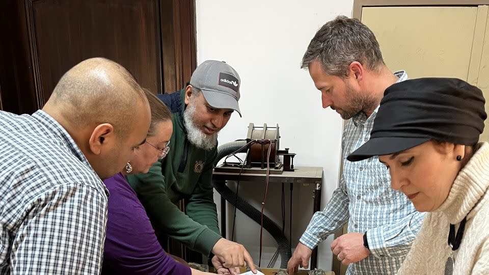
Born and raised in Egypt, Ghoneim was familiar with the cluster of pyramids in this area and had always wondered why they were built there. She applied to the National Science Foundation to investigate further, and geophysical data taken at ground level with the use of ground-penetrating radar and electromagnetic tomography confirmed it was an ancient arm of the Nile. Two long cores of earth the team extracted using drilling equipment revealed sandy sediment consistent with a river channel at a depth of about 25 meters (82 feet).
It’s possible that “countless” temples might still be buried beneath the agricultural fields and desert sands along the riverbank of the Ahramat Branch, according to the study.
Why this branch of the river dried up or disappeared is still unclear. Most likely, a period of drought and desertification swept sand into the region, silting up the river, Ghoneim said.
The study demonstrated that when the pyramids were built, the geography and riverscapes of the Nile differed significantly from those of today, said Nick Marriner, a geographer at the French National Centre for Scientific Research in Paris. He was not involved in the study but has conducted research on the fluvial history of Giza.
“The study completes an important part of the past landscape puzzle,” Marriner said. “By putting together these pieces we can gain a clearer picture of what the Nile floodplain looked like at the time of the pyramid builders and how the ancient Egyptians harnessed their environments to transport building materials for their monumental construction endeavors.”
For more CNN news and newsletters create an account at CNN.com

Dr. Sarah Adams is a scientist and science communicator who makes complex topics accessible to all. Her articles explore breakthroughs in various scientific disciplines, from space exploration to cutting-edge research.