Three blasts of energy from the sun are likely heading right toward Earth. Space weather forecasters believe this geomagnetic storm will create northern lights.
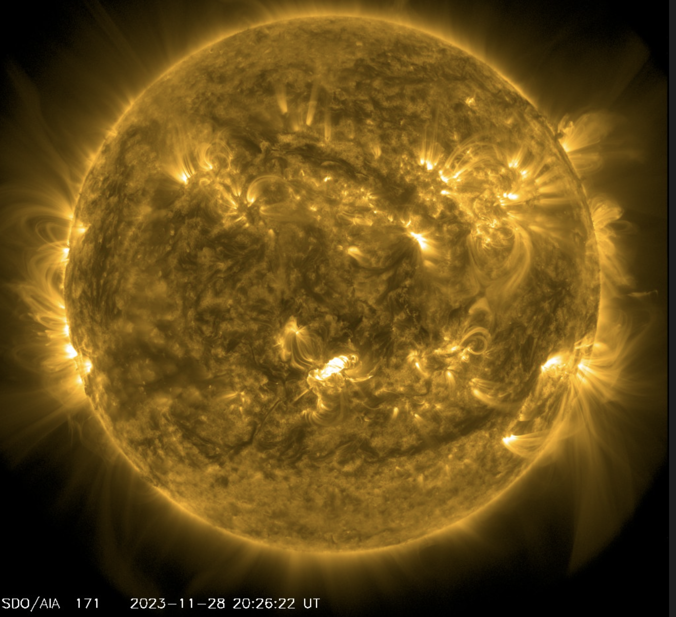
NOAA’s Space Weather Prediction Center (SWPC) detected a first Coronal Mass Ejection (CME) on Monday. A CME is the energy shot off the sun when a sunspot erupts. The first CME is moving toward Earth but expected to miss Earth’s atmosphere.
Then on the same day, November 27, two additional CMEs exploded off the sun’s surface and are heading toward Earth.
Finally on November 28 a very strong CME blasted off the sun’s surface heading straight toward Earth. The space weather forecasters at NOAA now say the final strong CME will catch up and merge with the second and third CMEs.
We won’t just have one CME hitting our atmosphere. We will have three CMEs merged into one large geomagnetic storm.
Forecasters project the arrival of the solar storm energy on December 1 around and after Midnight. This is when Michigan and a larger part of the northern third of the U.S. could see northern lights.
The strength of the solar energy hitting Earth’s atmosphere will dictate how far south the northern lights will be seen. The strength of a burst of solar energy is measured in the Kp Index. The forecast below shows the peak Kp Index being forecast to hit seven between 1 a.m. and 4 a.m. Friday. Forecasters also give that time period a 55 percent chance of a “strong-extreme” geomagnetic storm.
A Kp of seven could cause northern lights to be visible almost right overhead in the northern half of Lower Michigan, from Bay City to Muskegon northward. Northern lights could even be visible in the southern half of Michigan, but remember you have to be in a very dark location.
In fact the Kp index of seven is so strong, people in Indiana and Ohio could see northern lights.
Unfortunately this is a forecast made with only one data point right now- the time, direction and estimated speed of the CMEs as they left the surface of the sun. We only get another good update when the energy is about one hour from hitting Earth’s atmosphere. In other words we won’t get a new forecast using new data until late Thursday evening.
We also have to hope for clear skies here in Michigan late Thursday evening and early Friday morning. That certainly looks possible as an approaching storm probably will not send its clouds our way until between 3 a.m. and 6 a.m. Friday. Tomorrow I will give you a more complete look at the cloud forecast here.
ALSO: There’s some red on the temperature maps in Michigan’s future, and the warm-up has legs

Dr. Sarah Adams is a scientist and science communicator who makes complex topics accessible to all. Her articles explore breakthroughs in various scientific disciplines, from space exploration to cutting-edge research.