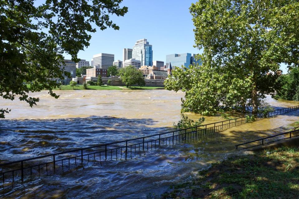
It wasn’t a hurricane when it hit Delaware on Sept. 1, 2021, but Tropical Storm Ida still produced torrential rains with the heaviest rains falling on southeastern Pennsylvania. The day after the storm, residents of northeast Wilmington described the weather as “beautiful” and “sunny” when the floodwaters came.
It’s been a little more than two years since the city’s largest flood in 200 years, which led to the destruction of homes and businesses and caused long-term impacts on the lives of residents. Flooding is the most common weather hazard in Delaware, a coastal state with the lowest average elevation in the U.S., according to the Delaware Emergency Management Agency. Due to climate change, the frequency of flooding is expected to increase.
In search of ways to reduce the impact of flooding on communities like northeast Wilmington, researchers at the Brandywine Conservancy and the Chester County Water Resource Authority in Pennsylvania and the University of Delaware’s Water Resources Center began to study the systems of water that flow from upper elevations in Pennsylvania to low-lying Delaware.
Later this year the Brandywine Flood Study will produce a report to explain why the Brandywine Creek is flooding communities and what can be done about it.
Gerald McAdams Kauffman, the director of the University of Delaware’s Water Resources Center, has been examining the lower Brandywine Creek and the flooding that devastated northeast Wilmington as a part of the study. He and his team have identified three main factors that contributed to the overwhelming volume of floodwaters that hit Wilmington’s 11th Street Bridge area in 2021. Findings that Kauffman said he hopes leaders consider as they plan future development — and insights residents could factor in when asked for their input.
Ida rain water is only part of the reason Northeast flooded
“I hate to say a perfect storm, but that’s exactly what happened,” said Kauffman, who also teaches at University of Delaware.
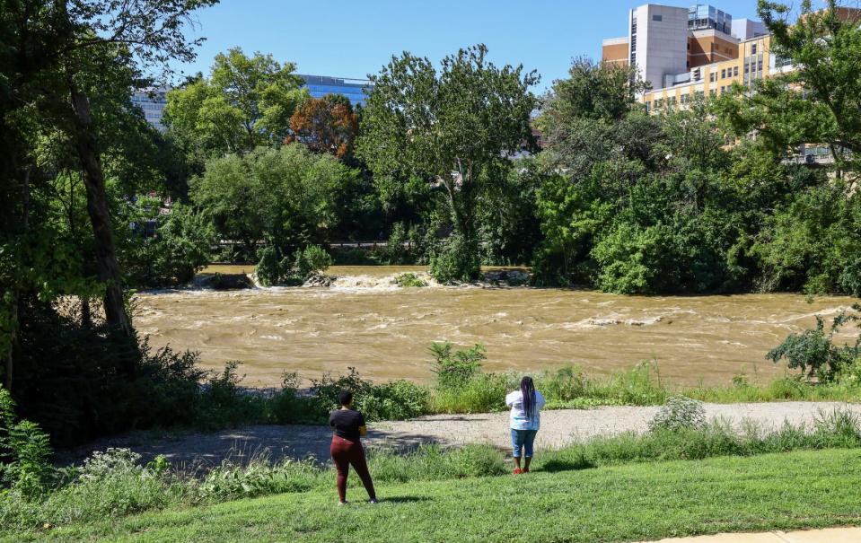
The Brandywine Creek is part of a large watershed or land that channels — or sheds — water into streams, creeks, lakes and oceans. It originates 30 miles north in Honey Brook, Pennsylvania. Geographically, Honey Brook is in the foothills of the Appalachian Mountains.
The once-in-200-year flood event began with ground already saturated from prior rains and waterways filled with water. According to Kauffman, Tropical Storm Ida’s water cascaded down from an elevation of a thousand feet, gathering more water as it flowed, including the eight to 10 inches of rain that fell near West Chester. It took the flood waters 12 hours to run through the funnel-shaped watershed from its wider end in Pennsylvania and into its narrow end in Wilmington’s northeast area. At the same time, the tide came in.
Tidewater from the Atlantic and quarry pit added to the brew
As floodwaters raced downstream from Pennsylvania, water from the river’s other end also rushed in. The Brandywine Creek joins the Christina River near Seventh Street on the city’s East Side. Both rivers receive and exchange water with the Atlantic Ocean through the Christina River’s connection to the Delaware River. The floodwaters from Ida happened to hit Wilmington as tidal water from the Atlantic Ocean pushed up the Delaware River, continued into the mouth of the Christina and into the Brandywine.
Helping to pool the influx of water is an early American quarry pit. During the 17th and 18th centuries, European settlers dug several quarries along the creek to mine blue rock for building colonial structures that still stand today. Researchers have identified one quarry pit not filled in high enough. Located near 13th and Church streets, the quarry pit’s depression allowed the water to collect. Eventually, the water spilled into the streets, businesses and homes.
Debris jams and an overwhelmed sewer also contributed to the flooding.
Meeting with residents of Northeast Wilmington
Hoping his findings would encourage northeast residents to take a more active role in flood mitigation planning, Kauffman attended a community meeting in early January to present his research. Several residents at the meeting were already familiar with some study conclusions, such as the quarry pit depression and the entry of tidal waters. They also offered their suspected reasons for the flooding.
Joshua Henson, a 40-year resident of northeast said the waterway used to be deep enough for ships to pass. He informed Kauffman that the bridge at 11th Street had been a drawbridge. He said damming the Brandywine transformed it from “a lake” into the stream it is today. It also pushed sediment downstream and over the years, dirt was added and housing was built.
He said the floodwaters are just returning to the waterway’s natural ground and that residents are in danger similarly to how New Orleans residents during Hurricane Katrina. “They popped the hole and put [water] down the Black neighborhoods and killed all them people. And they’re doing the same thing here,” Henson said.
Because the floodwaters came the day after Ida, Henson and others believe that the flood was partially caused by Pennsylvania authorities releasing their floodwater into the Brandywine Creek.
Having researched the flood, Kauffman said, “It was just a pure rush of water that came down from the storms that happened that previous day.” He said that the 4 billion-gallon Marsh Creek Reservoir in West Chester, Pennsylvania, actually helped mitigate the amount of water that could have hit Wilmington.
Henson believes Black residents are being incentivized to stay at their detriment, Jaehn G. Dennis, president of the Vandever Avenue Civic Association said he hopes more residents come out to learn about the issue. He said damming is a cause of worsening flooding in the area and proposed cleaning the storm drains as a way to reduce flood risk. Others suggested dredging the river to remove the accumulated sediment.
What solutions are there?
Under the threat of more flooding, this section of the city is being targeted for more homes and businesses. Millions of dollars are being invested to address flooding and to create the city’s next major economic center.
According to John Rago, deputy chief of staff to Wilmington Mayor Mike Purzycki all options for redevelopment are being explored. “The city has aspirations for both flood-resiliency infrastructure as well as residential and commercial development,” he said. “We have all options on the table because this area along the Brandywine River has the potential to be Wilmington’s second riverfront district,” Rago said in October.
Kauffman believes it’s “important for the residents of Northeast to be involved in decisions that are made.”
FROM BROWNFIELDS TO GREEN: After historic flooding, Wilmington looks to create green spaces in city’s Northeast
He supported northeast residents’ suggestion of dredging the river to remove the built-up sediment, as well as the idea of cleaning the storm drains to reduce the risk of flooding. Kauffman said the community would benefit from adding trails that lead down to the river and increasing green spaces while reducing the amount of concrete.
He also said he would like input from residents regarding the proposed sub-resistance park. It’s an idea that the city is considering and one his office endorses — although he’d prefer fewer buildings and more green space, including pollinator gardens would be incorporated.
Ideally, he said re-establishing the area as a maritime forest would be the most effective method for restoring the health of the waterway. “Sometimes there aren’t solutions to the severe environmental problems, but this one’s this one’s fixable,” Kauffman said.
Yet, despite Kauffman’s optimism, Henson, the long-time Northeast resident who attended the community meeting, remained skeptical. Based on his understanding of the water’s natural path, he said that there is little that can be done to prevent the flooding.
Contact reporter Anitra Johnson at [email protected]. Join her on the Facebook group Delaware Voices Uplifted. Support her work and become a subscriber.
This article originally appeared on Delaware News Journal: Tropical Storm Ida research finds reasons for flooding in Wilmington

Amanda Smith is a dedicated U.S. correspondent with a passion for uncovering the stories that shape the nation. With a background in political science, she provides in-depth analysis and insightful commentary on domestic affairs, ensuring readers are well-informed about the latest developments across the United States.